Pre-flight planning the four corners regionMany large wind farms on the wayOn the way out over Iowa and Kansas with many irrigation circles and cattle lotsLots of them. Started flight following with the increasing haze.Flying into haze from fires in the northwest, oh yea, and mountains about 100nm ahead
Colorado Springs
Cutter Aviation FBO at Colorado Springs AirportAn aviation bear greets the pilots and passengers to the FBOI like the aviation bearThe KC-97 Airport Restaurant at Colorado Springs airportThe wing extends into the restaurantThe propeller and nacelle are inside the restaurant too.Kids get to pretend to be pilotsThe cabin is also for restaurant seatingIn Old Colorado, look closely at the windows... Leg lamps!
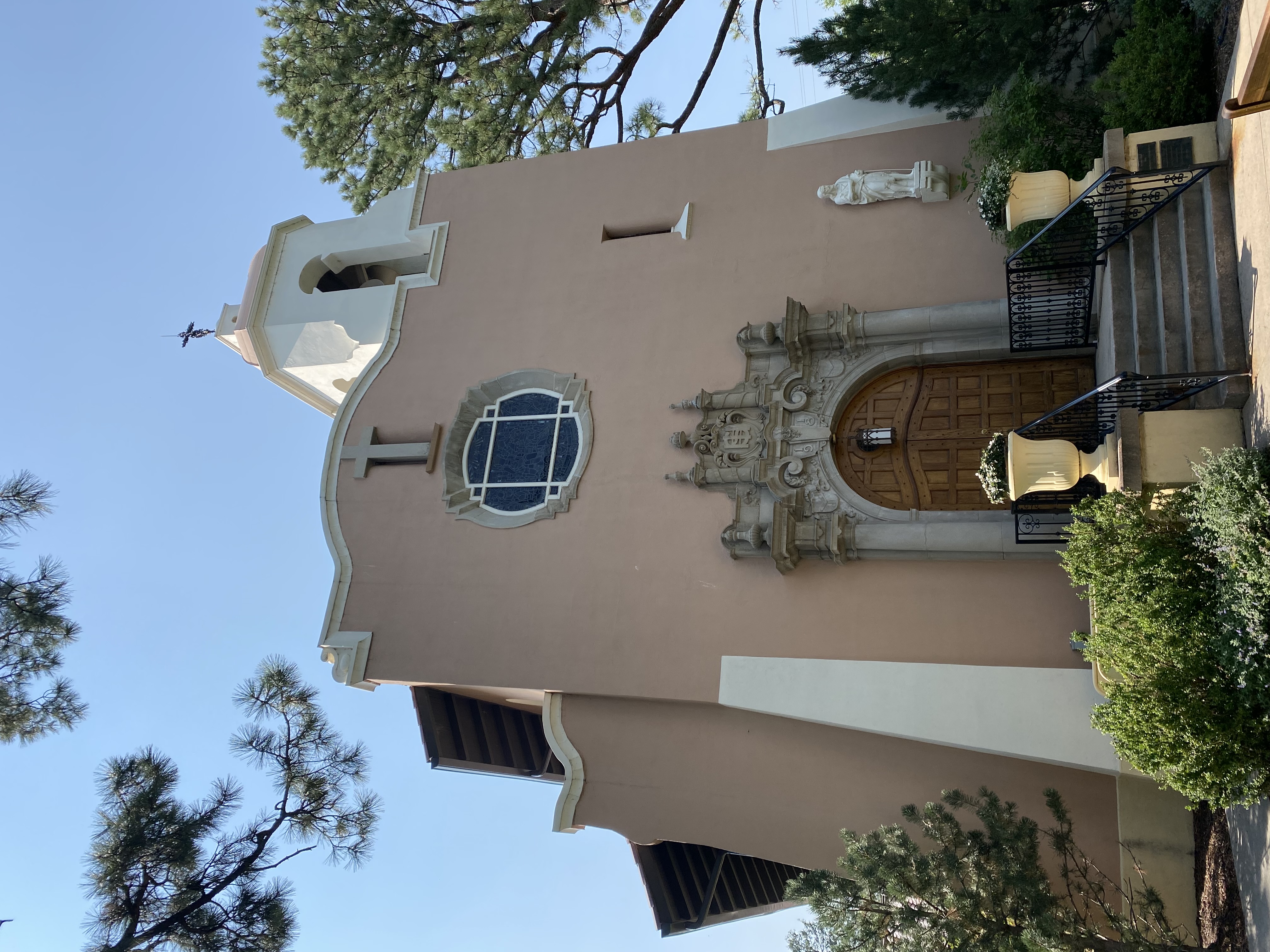
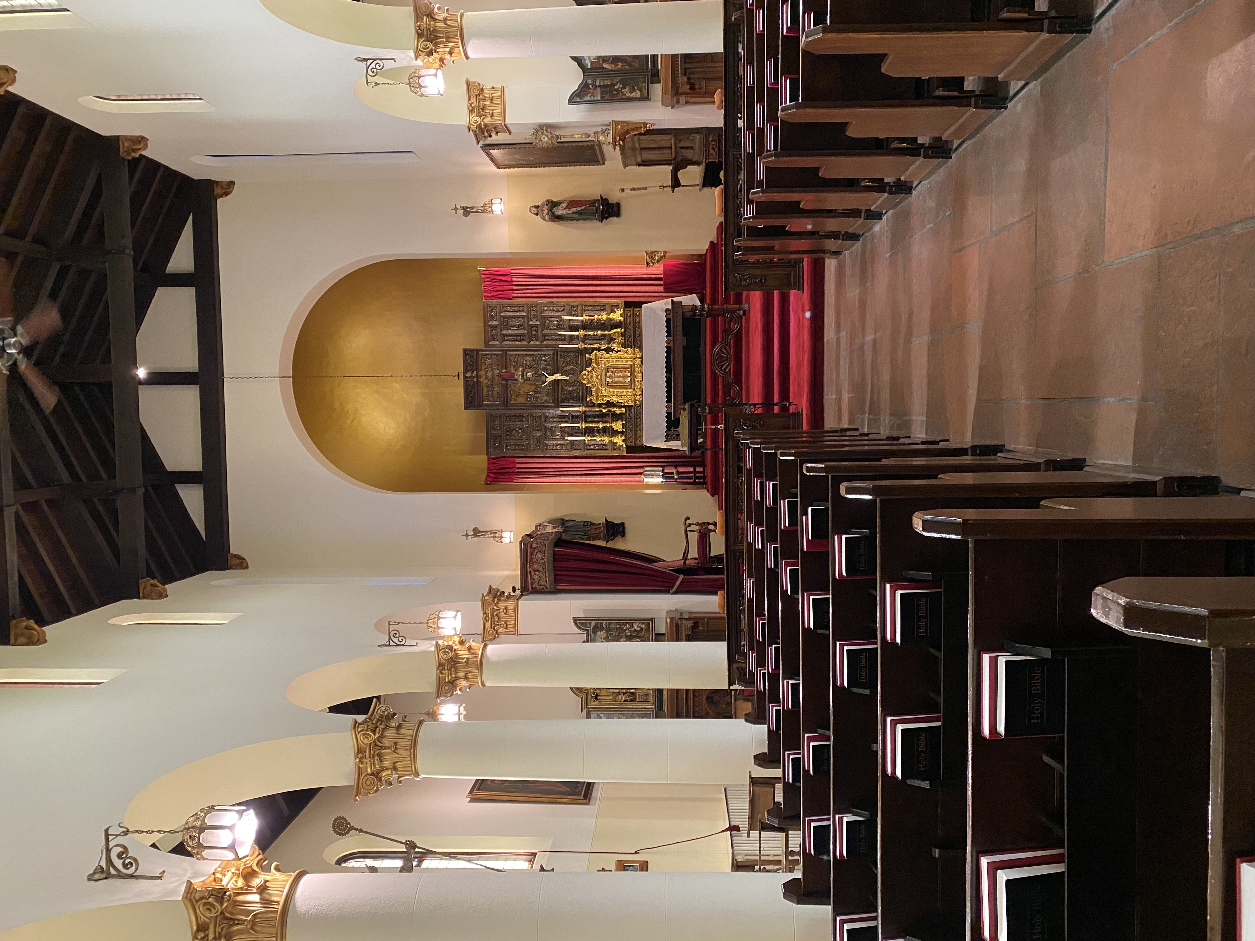
The Broadmoor
Cheyenne Lake at the BroadmoorOne of the entrancesThe Pourtales Library at the Broadmoor for guestsBookshelves in the Pourtales Library. Even a ladder like a real library.Pauline ChapelInterior of the chapel
Flourissant and Woodland Park
Fossilized trees at the Flourissant Fossil BedsThe field was once the bottom of a volcanic mud flowThis one has a broken off saw blade embedded in it.The trees are just below the surface of the whole field.An old homestead at the site.The Rocky Mountain Dinosaur Resource Center in Woodland Park, Colorado.80 million year old raptor cast
Day trip to Leadville
Garden of the GodsPikes Peak off to the south.Pikes Peak on the leftAhead, a ridge to a central Colorado mountain valley.Eleven Mile Reservoir over the ridge.U.S. Hwy 24 at Wilkerson Pass. Badger mountain.Terrain ahead. Red is at or below me. The Arkansas river valley is about 12 nm ahead. Turn right there to Leadville.Flight following U.S. 24 (mp4)Buena Vista airport and the 14ers to the west. Up the valley to the right to Leadville.Following the Arkansas river north.Twin Lakes Reservoir (9176ft MSL)Leadville airport, ahead on the right and the town to the north.Leadville Airport has a large, brand new ramp at 9934 ft MSL.On the ramp at LXV, looking at the 14ers and Mt. Elbert to the west
Leadville, CO
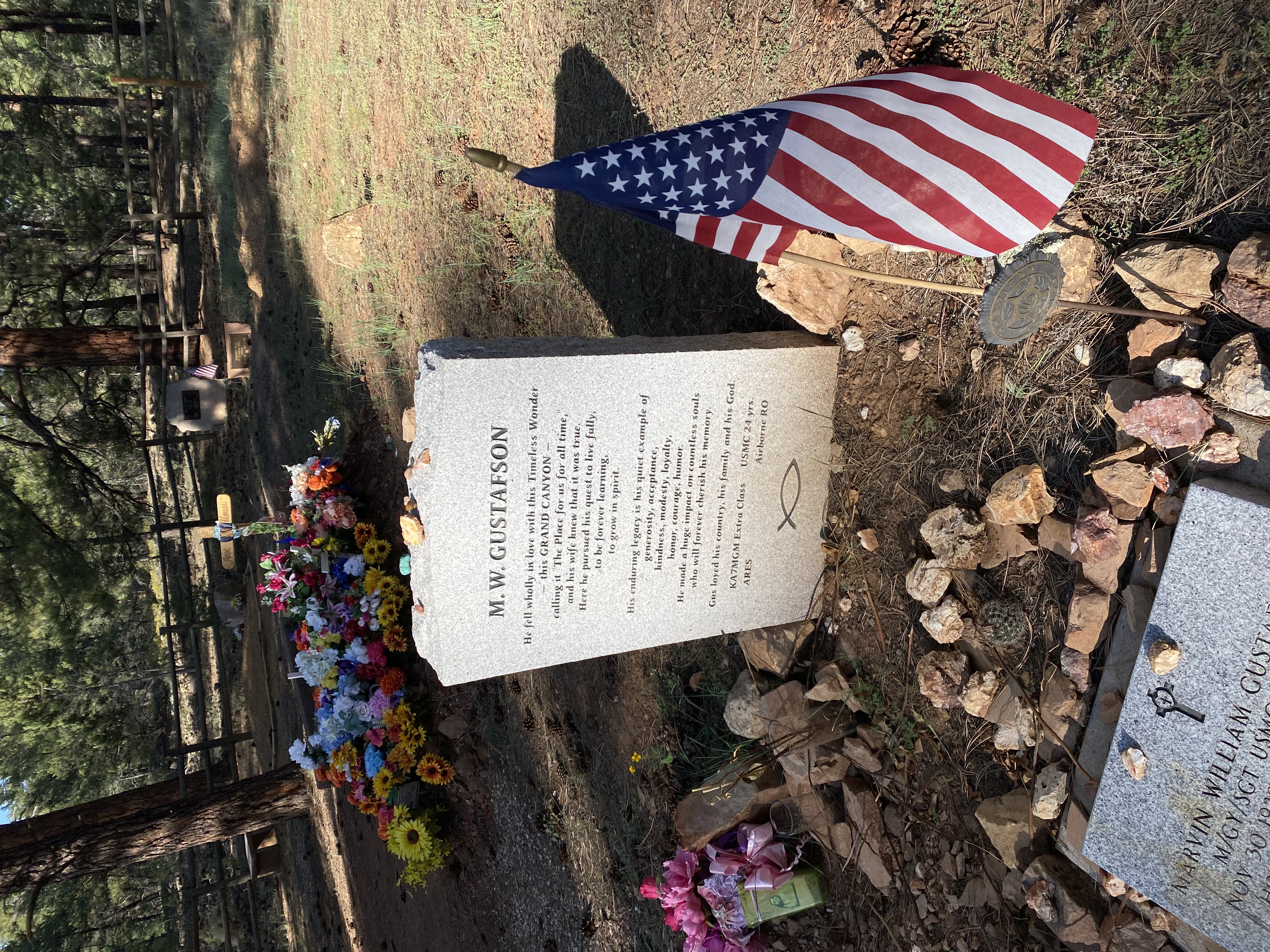
The National Mining Hall of Fame & MuseumIt has a coal mine replica.A mule and miner.Winch operatorEven rails on the groundA walk through the mine (mp4)Baby Doe Tabor's cabin. The story of her life is an interesting read.Inside the cabinMine shaft outside the cabinHistoric Silver Dollar SaloonInside the Silver Dollar SaloonHigh Altitude Thirst Aid Center. Unfortunately not today.Leadville airport looking southJust past Woodland Park and starting to see Colorado SpringsA great sunset from the hotel room window
One of many hairpin turns where the road just disappears around the curveA marmont living in the rocks and making it's "whistle pig' squeakBoulder Park at mile 17.5 and 13,380 ftPart of the new overlooks on top of Pikes Peak, 14,114 feetGoing down you put the car in 1st gear and let gravity propel you and the engine brake for youA walk along the cliff (mp4)Coming up to a curve, 1st gear whiningScale is incredible in the mountains
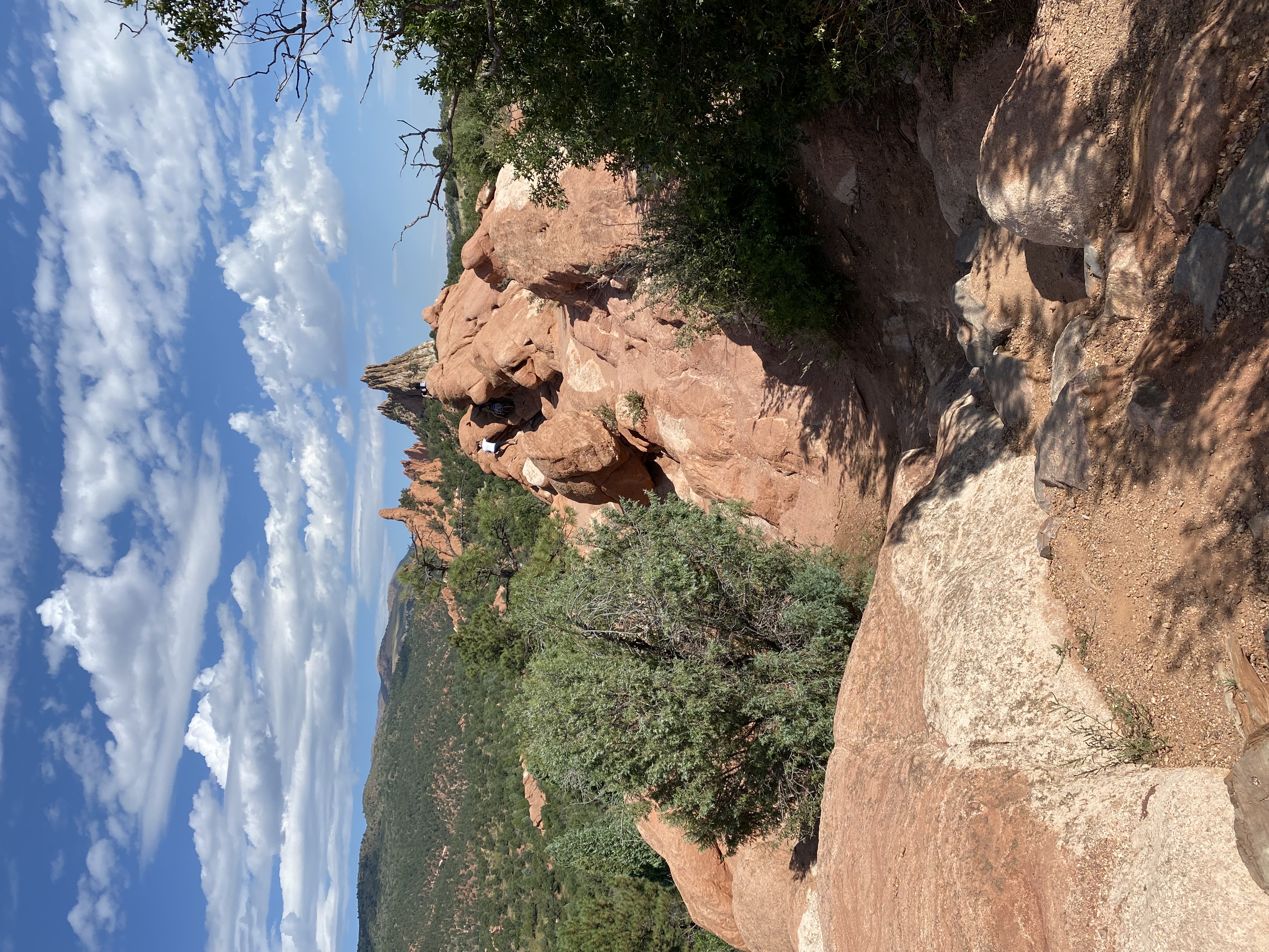
Garden of the Gods
Southern entrance to the Garden of the GodsGrey Rock / Cathedral RockThe plaque noting the donation of the park to the city of Colorado Springs, free for all to enjoyA very large rock gardenNumerous climbers were outTower of BabelSignature Rock from north parking lotDifferent levels of climbing
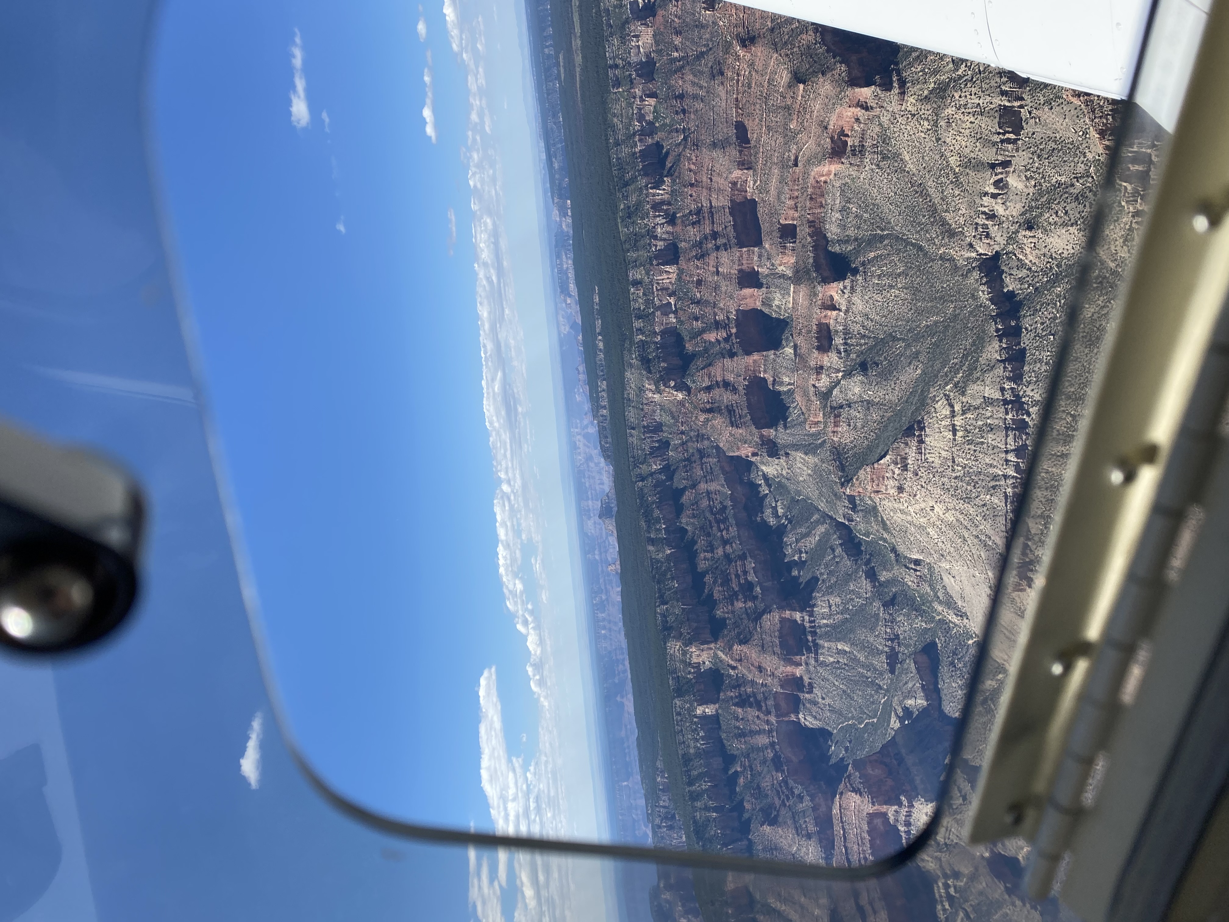
Blanca Peak at the La Veta PassGreat Sand Dunes National Park in the distance to the north.Almost 15,000 gives good clearance over the upcoming Wolf Creek PassComing up on Wolf Creek PassShiprock in the distanceShiprock is a magnificient navigation aidA closer view of ShiprockA ridge line running to the south from ShiprockTerrain starts to get more red with mesas and valleysMonument valleyMonument Valley airportA closer look shows the one way in and one way out due to the unfortunate mesa to the south.Western edge of Monument ValleyThe Colorado River runs through Marble Canyon from Page, AZ to the Grand CanyonMarble Canyon (mp4)Flight down the Zuni Point corridor above 10,000 ftColorado River (mp4)Copilot viewCopilot view
Plateau Point, on the left, is a 12 mile round tripUp to the railing (mp4)And over the railing (mp4)View of Bight Angel trail and the green area is Phantom RanchUtah JuniperElk grazing next to the El Tovar hotelFirst rock portal on the trailThe start of the Bright Angel trailPetroglyphs at the start of the Bright Angel TrailNo handrails, but it's not as narrow as it looks.Mary Colter's Lookout StudioThe view from Lookout StudioThis huge branch was caught in the railingBright Angel trail to the North RimA clash of distancesJust west of the village, there's a layer of fossils in the rockMore fossils in the rocksLayers of rock from the seabed, now at 7,000 feetShell fossils in rock at 7,000 feetAn embedded clam shell fossil in the rockIndian Paintbrush / Prairie-fire flowerShrine of the AgesThe Grand Canyon BlacksmithQuite a headstone, and a ham radio operator call sign on itA Harvey Girl
Grand Canyon to Dodge City
Canyon de ChellyCanyon de Chelly (mp4)NM landscape (mp4)NM landscape (mp4)The Rio Grande Gorge Bridge at Taos, NM. It's been in numerous movies.The Rio Grande bridge (mp4)Taos, NMEagles Nest valley aheadPalo Flechado Pass to Eagles Nest (mp4)Flying north up Eagle's Nest valley to the pass ahead on the rightEagles Nest Lake, NMFirst stop after the last mountain ridge, Raton, NMMesas and old volcanos near Raton, NMFlatlands againAnd cattle stockyards
Dodge City, KS
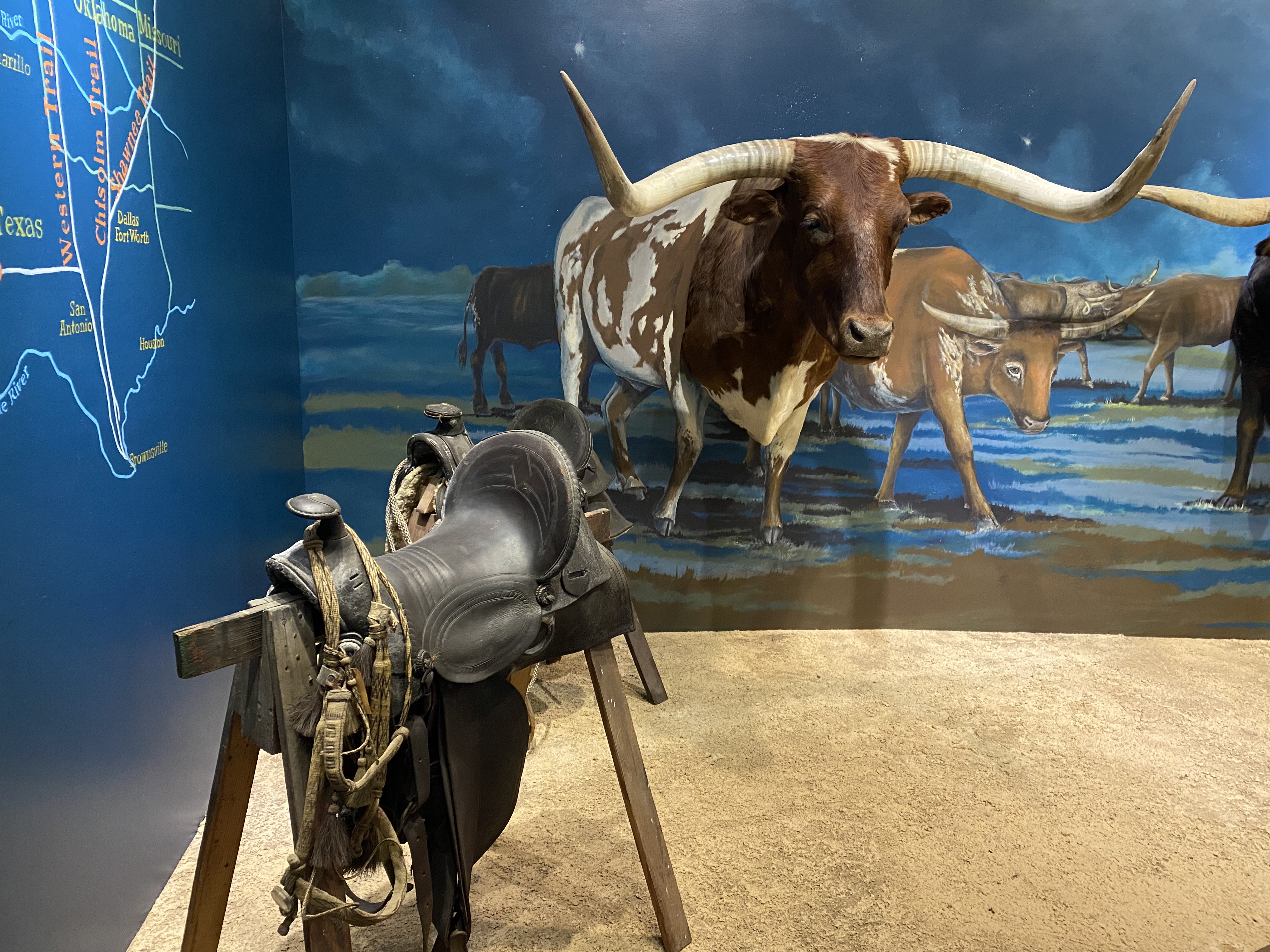
Boot Hill Museum in Dodge City, KSSnake oil bottles, without the snake oilA virtual visit with Wild Bill, Earp, Masterson, and Doc HollidayBoot Hill replica main street1800's firearmsWyatt Earp
Last legs home
Stopped in Mexico on the way out and back. That's Missouri. The Zenith Aircraft company is based there.The Zenith Aircraft companyMidwest clouds and flatlandsGreat VFR weatherWe couldn't pass up Rick's Boatyard in Indianapolis on the way home.